I’ve been working on a new project recently which involves creating high-resolution 3D renderings of terrain which are processed from images taken in low flight.
I plan to experiment with comparing reconstructed models over time to detect erosion for both inland and coastal features, take multi-spectral images to monitor plant/crop health, and create beautiful works of art that represent human flight and attempt to capture what seems impossible with a simple photograph of a mountain.
See the full 3D render here: https://memento.autodesk.com/projects/mission-slide
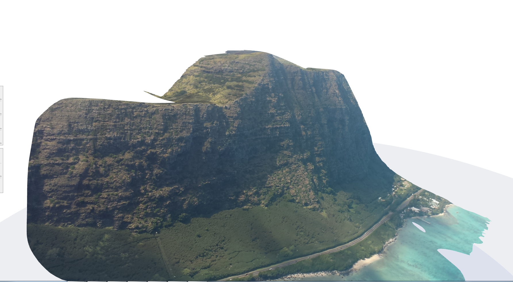
Photogrammetry of Makapuu on Skywalk Arriba 3